Field Triangulate
Quickly and easily determine a remote GPS location from two, or more, geolocated points with compass bearings to that location.
Specifically designed for use in the field, Field Triangulate supports:
- Fully automated use of iOS device location. Compass bearings are best manually entered.
- Manual entry/edit of any/all readings.
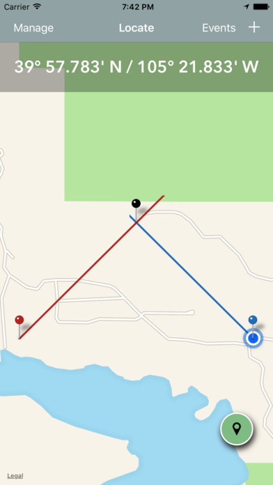
- On map display in various display modes.
- Manually update device bearings (e.g. for use with a compass.)
- Share the triangulation to others.
- Multiple latitude/longitude formats:
- Decimal degrees
- Degrees and decimal minutes
- Degrees, minutes and seconds.
- Automatic location to address lookup.
Basic usage:
Use your iOS device & compass to take bearing on a remote location from two locations and Field Triangulate will calculate and display the GPS coordinate for the remote location.
Advanced usage:
Enter readings provided from a remote person (perhaps by iPhone or radio) and add your own readings manually in order to calculate a remote location.
Radio Telemetry
Radio telemetry involves triangulation to track the movements of individuals of a species via radio signals produced via tracking collars or devices. Be it wolves, mountain lions or wildfowl use Field Triangulation to calculate the location of the target animal.
Wildland Firefighting
In wildland firefighting triangulation is used to locate a remote smoke plume. This can save time and a lot of effort, especially when the fire is in remote mountains or woods.
Responserack for Volunteer Fire Departments
Note: For Volunteer Fire Departments please evalute Responserack as fire department software. Responserack supports NFIRS 5.0 and is targeted volunteer fire department software. Learn more about what Responserack can do for your volunteer fire department