Field Triangulation for Wildland Firefighting
Wildland firefighters use triangulation to estimate a location of a remote smoke plume, to reduce "smoke chasing". Taking bearings to a visible smoke plume, especially one that is intermittent or less visible upon approach, can provide a fixed target location to hike to. This can save time to get onto the fire, and be safer when navigating in the mountains.
Triangulation to a smoke plume
How to use Field Triangulate to triangulate a smoke plume...
Take two, or more, readings (GPS location and compass bearing) towards the smoke plume. Use vantage points as far apart as practical, in order to get the largest angle between the readings. This spread provides the best accuracy for the final result. Use readings from two or more crews, if available, sharing them by radio or messaging. Store the triangulated GPS location, and save it as a "go to" in GPS devices. Navigate to the triangulated location as appropriate to terrain and conditions.
Note: For the best accuracy use a hand held compass, since mobile device compasses are not sufficiently accurate, and do NOT report their (in)accuracy. Keep away from fire apparatus, since the metal in these can impact compass readings.
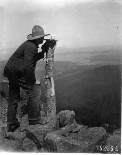
1939 - Big Lake Lookout locating a fire by triangulation on the Apache fire map.
- photograph by U.S. Forest Service.
Steps to triangulate to a smoke plume
Take two or more readings (preferably from points with a reasonable distance separating them) such that the angle between readings is as large as practically possible. The triangulated point is best when the angle between readings is close to perpendicular (i.e a 90º angle.)
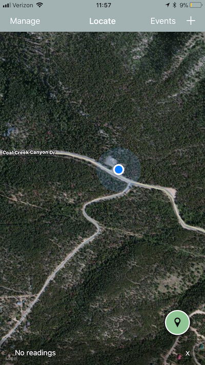
Step #1 - Upon Launch / New Event
Upon launch the application will present a map and locate your current position.
Press the green circle button to add a new reading.
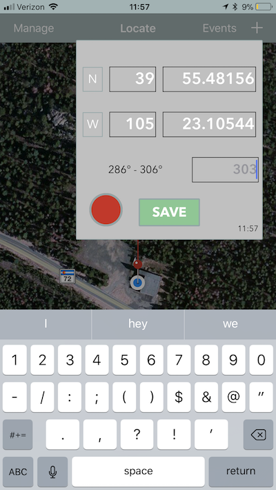
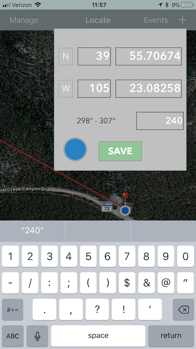
Step #2 - Enter the first reading
Your latitude & longitude will be entered automatically, prompting you to enter a bearing to the smoke plume.
For devices with an onboard compass the current bearing is available. When entering the bearing the default value is the current compass reading, so you can point the device at the smoke, although this is not highly accurate.
Note: For best accuracy use a hand held compass, not the device compass. (Device compasses do NOT report on any inaccuracy, so their values cannot be fully trusted.)
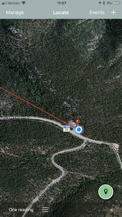
Step #3 - that reading is displayed
The reading will be added to the map as a pin, and a line drawn to the bearing.
Note: The line and pin are drawn in the same color as was shown on the reading.
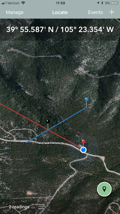
Step #4 - Add a second reading
Add a second (or subsequent) reading from another location. The greater the angle between readings (up to a 90º angle) the more accurate the triangulation. A second reading that is only a small angle away will likely lead to an inaccurate triangulation.
A second response crew could take this second reading and communicate it via radio. Enter the second reading into the device to combine them into one result.
Note: Use a "Long press" on a location on the map to enter a remote location at that point. You can edit the latitude or longitude to match the location of the remote crew.
Step #5 - Triangulated latitude / longitude displayed
The intersection point is the calculated latitude / longitude for the smoke plume. This triangulated latitude / longitude is displayed as a black pin, and the latitude / longitude GPS values are shown at the top of the map.
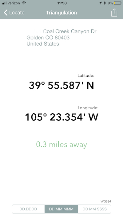
Step #6 - View and share the Triangulation
Tap the triangulated reading to get a brighter / clearer view of the values. Either enter these readings into a GPS "go to" or communicate the location with the responding crews.
Note: Here you can share the reading with others via messaging, email and others.
Responserack for Volunteer Fire Departments
Note: For Volunteer Fire Departments please evalute Responserack as fire department software. Responserack supports NFIRS 5.0 and is targeted volunteer fire department software. Learn more about what Responserack can do for your volunteer fire department